
Morris County ZIP Code Coverage
The County Clerk's 2013 manual is the county-specific crosswalk for local postal geography. It lists 66 distinct ZIP codes in its county table, but it is a reference source rather than a current delivery guarantee. The full Morris County ZIP code directory therefore needs two fields in every search note: the ZIP used by the address and the legal municipality or tax district. The samples below show why a post-office label is a useful lead but not a boundary decision.
| ZIP | Areas Covered | Post Office | Notes |
|---|---|---|---|
| 07005 | Boonton, Boonton Township, Deer Pond, Powerville, Rockaway Valley, Sheep Hill, Taylortown | Boonton | Also appears in rural and neighboring-community entries |
| 07405 | Butler, Kinnelon, Bald Hill, Brook Valley, Fayson Lakes, Smoke Rise | Butler | Kinnelon uses a Butler postal anchor in the manual |
| 07834 | Denville and numerous lake and hill communities | Denville | Also appears in Parsippany and Rock Ridge Lake references |
| 07853 | Washington Township, Flocktown, Four Bridges, German Valley, Hacklebarney area | Long Valley / Schooley's Mountain | Several local postal contexts appear in the manual |
| 07927 | Hanover and Horse Hill | Cedar Knolls | Postal city differs from the township name |
| 07940 | Madison and several Harding community references | Madison | Municipal research still needs the legal municipality |
| 07960 | Morristown, Morris Township, and Harding historic-park references | Morristown | Not proof that an address is in Morristown municipality |
| 07981 | Hanover and Eden Mill | Whippany / Convent | More than one local postal context is listed |
Other table entries include specialized references such as 07962 for Morristown's Ridgedale Avenue and 07963 for county government offices. They should not be assumed to be ordinary residential delivery areas. Current delivery and local jurisdiction must be confirmed for the specific address.
Morris County ZIP Code Crosswalks
The manual shows postal relationships that are easy to miss in a name search. Hanover has Cedar Knolls at 07927 and Whippany at 07981, with nearby 07950 references. Harding can appear with New Vernon 07976 or other postal communities. Chester Township can be connected to Flanders 07836, Ironia 07845, Gladstone 07934, or Chester 07930. Those labels are valuable search breadcrumbs in an old directory or newspaper, but the municipality controls which clerk, tax district, or registrar should receive a records request.
Rural and lake-area terms need the same care. The crosswalk connects Rockaway with 07866 and related rural addresses in 07005, 07801, and 07885. It also connects Mount Arlington and Roxbury entries across 07856, 07885, 07876, 07850, 07852, and 07836. A ZIP code may narrow a place name, yet it cannot substitute for an official parcel identity or a municipal boundary check.
Note: The County Clerk manual dates to 2013, so preserve its postal label as historical context and use USPS for a current address result.
Morris County Postal Names and Municipalities
A postal city can cross a municipal line. The County's own examples include 07046 for Mountain Lakes and Fox Hill in a Parsippany context, 07935 for Green Village and Chatham Township references, 07950 for Morris Plains and a Parsippany Littleton Corner reference, and 07976 for Harding and New Vernon. Record both the postal city and legal municipality in a research log. That practice keeps a historical directory mention from being assigned to the wrong government custodian.
Morris County has 39 municipalities, and local records are generally municipal rather than countywide products. The County Cities and Towns directory is the first boundary check before contacting a municipal clerk. For property research, the tax district is the next important field. A postal label may be familiar to the mail carrier while having no role in the tax or recorded-document system.
Checking a Morris County ZIP Code
The official USPS ZIP Code Lookup is the current-delivery check after county geographic research. Enter the delivery address as completely as possible, confirm the returned ZIP and postal city, and retain the date of the lookup. USPS answers a postal question. It does not decide the municipality, tax district, parcel boundary, or record custodian.
| Lookup mode | Address-to-ZIP lookup |
|---|---|
| Search input | Complete delivery address for the location being checked |
| Result to retain | Returned ZIP code and postal-city form, with the date checked |
| Next check | Legal municipality and tax district from county or municipal sources |
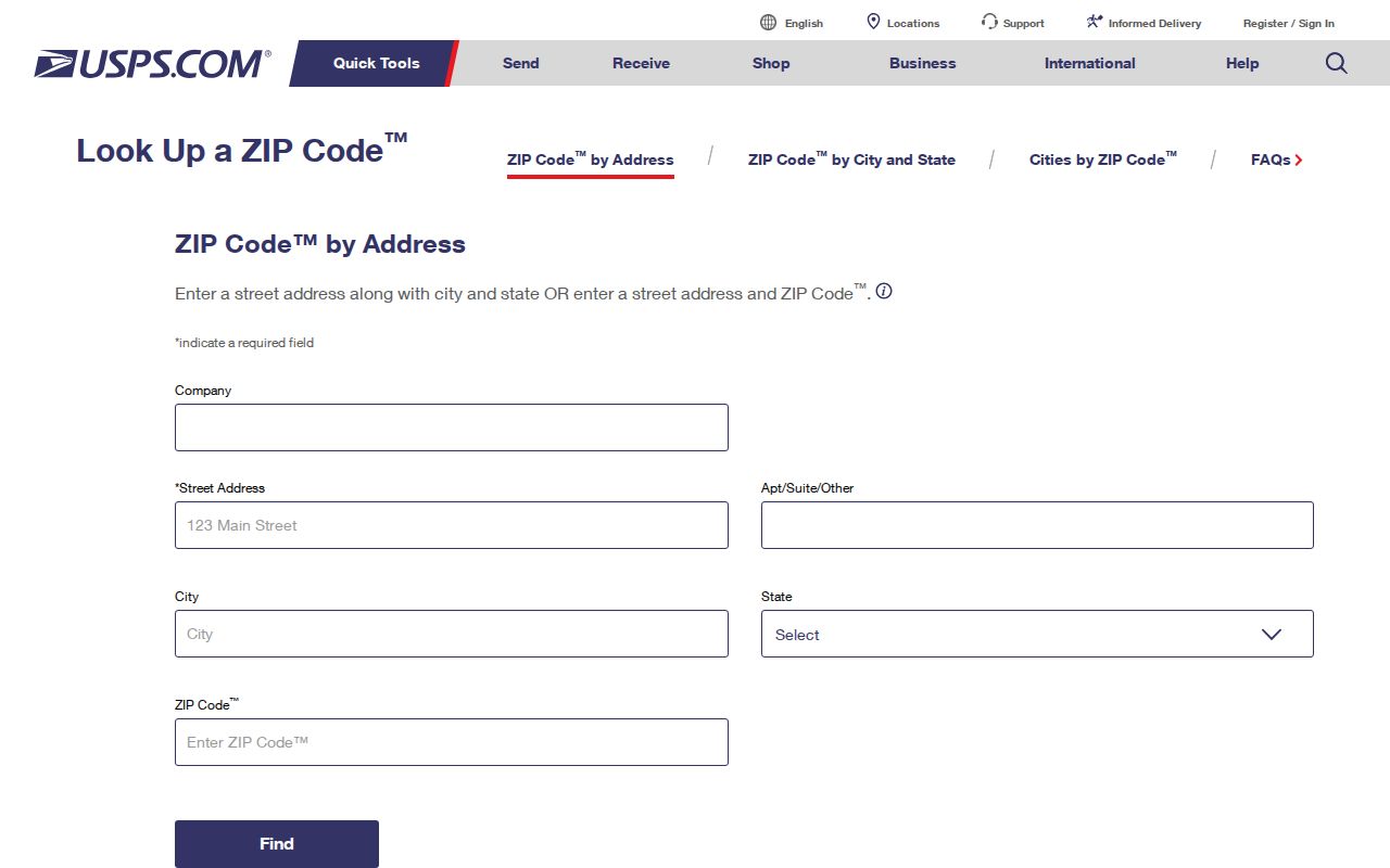
The lookup screen is useful when an address appears in an old directory under a community name that differs from the current postal style. Compare the delivery result with the County Clerk crosswalk and the municipality before using any government portal.
- ZIP code and ZIP+4
- The five-digit ZIP identifies a delivery area. ZIP+4 adds a more precise delivery segment and does not establish a property boundary.
- PO-box ZIP
- A ZIP used for post-office boxes or specialized postal service; it should not be treated as a residential delivery area without an address-specific USPS result.
- Unique ZIP
- A ZIP assigned to one organization or government destination. Morris County's 07963 county-government reference is a specialized example in the manual.
- Carrier route
- A mail-delivery sequence within postal operations. It is not a municipal line or a roster of everyone receiving mail nearby.
Morris County ZIP Code Search Routing
A ZIP code is not a filter for every Morris public system. The Tax Board accepts property, owner, block, and prior-block searches. Its fields rely on tax year and district, then a street, owner, or parcel identifier. The GIS viewer can show parcel geometry and help recover a block and lot, but it is not a postal database. New Jersey voter status tools are person-oriented, and the published voter-file formats are alpha, telephone, street or history rather than a guaranteed ZIP-wide web list.
| Tax Board mode | Required fields | Optional fields | What it returns |
|---|---|---|---|
| Property | Tax year, district, street name | House number | Matching parcel lead, not a ZIP-wide household list |
| Owner | Tax year, district, owner | None stated | Parcel association for the selected year and district |
| Block | Tax year, district, block, lot | Qualifier code | Parcel keyed by local tax identifiers |
| Prior Block | Tax year, district, prior block, prior lot | Prior qualifier code | Earlier parcel identity after a change |
- Validate the known delivery address with USPS and save the returned postal city and ZIP code.
- Use the County Clerk crosswalk and the County municipality directory to identify the legal municipality and tax district.
- Run the Tax Board property mode with its required year, district, and street fields, rather than expecting a ZIP-only search.
- Use Morris GIS to check parcel context and recover a block or lot for a narrower official search.
- For a street-level records trail, continue with the Morris County street-address directory after the municipality is confirmed.
A tax result can support a parcel or owner lead, but it cannot establish who occupied the property. Vital records follow an event place and registrar, while historical directories may use a postal community name. Each record question must go to its own custodian.
Morris County ZIP Codes Are Not Rosters
Postal geography cannot identify all residents along a route. A single ZIP contains many households, businesses, institutions, and delivery patterns. The Tax Board returns matching parcels, not every person in a ZIP. GIS helps with maps and identifiers but expressly does not function as a legal survey or postal system. Treat a ZIP result as an address-validation step, then seek the appropriate official record for the narrower question.
Current address material may also be limited by confidentiality programs or redactions. A listing in a directory, tax result, or postal result can be incomplete or outdated. Avoid inferring occupancy from a parcel, a delivered postal city, or a name that merely appears near an address.
Morris County ZIP Code Research Notes
Keep postal and legal geography in separate fields. A careful Morris County ZIP code note records the full delivery address, the USPS result and date checked, the postal city, the legal municipality, tax district, and the source being searched. If property is involved, add the block, lot, qualifier when present, tax year, situs address, mailing address, and legal-description reference. Those entries make it possible to reproduce a result even when a postal label and municipal name do not match.
| Postal evidence | Delivery address, USPS ZIP result, postal city, and date checked |
|---|---|
| Municipal evidence | Legal municipality and tax district used for the records search |
| Parcel evidence | Tax year, block, lot, qualifier, and situs address where the official result provides them |
| Source citation | Portal or custodian, search mode, result date, and any record or image reference |
The distinction matters after subdivision, merger, or renumbering. The Tax Board's prior-block mode preserves an earlier parcel identifier, while a deed or recorded map may use a legal description instead of a familiar street or postal form. Morris GIS can help relate the locations, but its parcel polygons are planning representations, not legal surveys. An official tax map, municipal office, or recorded instrument provides the next verification step.
Morris County ZIP Code Boundary Limits
The mismatch between postal and municipal geography is clearest around Morristown. ZIP 07960 is associated in the manual with Morristown, Morris Township, and Harding references including the Morristown National Historic Park and Mount Kemble Lake. The same ZIP can therefore be a sensible postal lead while pointing to different municipal offices. Specialized 07962 and 07963 references make another reason to verify the exact address before assuming an ordinary delivery area.
Use the municipality and tax district for property questions, the delivery address for USPS validation, and the specific event place or registrar for vital-record questions. A situs address is the tax or property location; a mailing address is where notices go; a legal description is the land identity in a deed. Those categories can overlap, but they are not interchangeable. The Morris County ZIP code directory works best when it preserves each field separately.
Note: Current postal delivery can change, so the official USPS result and the responsible municipal office control over an older county crosswalk.